
Viljandi County · Mulgi Parish
Ruhijärv
Ruhijärv is a long, gently curving lake on the southern slope of the Sakala Upland. Forests, fields and quiet shores frame a waterbody whose shallow areas, deeper western trough and rich cultural history make it valuable for nature education.
The lake receives water from streams and ditches and drains through the Ruhja River. Its north-eastern shore includes an RMK recreation site, and the lake belongs to both a protected area and a Natura nature site. Bathymetric fieldwork was carried out by the Tallinn University Centre of Excellence in Ecology in 2025.
About the lake
Landscape, water, life and stories
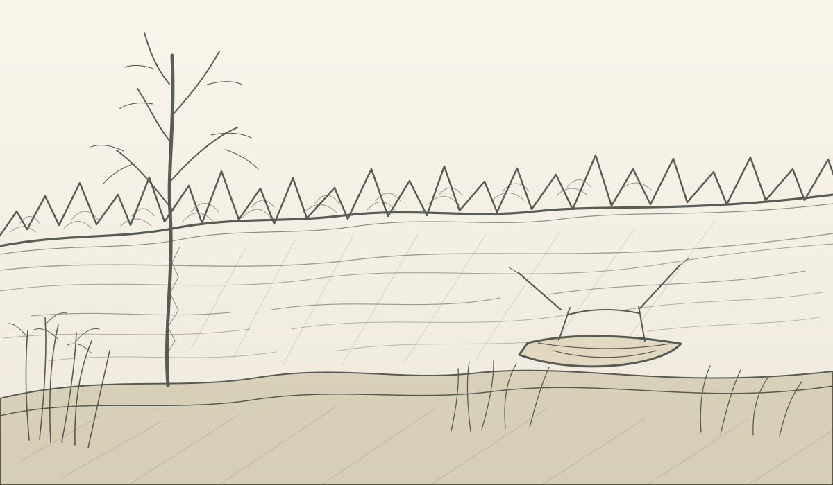
Ruhijärv lies near Lilli on an undulating moraine landscape. The lake is elongated from northwest to southeast, with mostly gentle sandy or peaty shores. The bottom is sandier near the shore and muddier in deeper areas.
The water is generally well mixed and warms relatively easily. Historical descriptions mention medium transparency, periodic blue-green algae blooms and diverse aquatic vegetation. The lake has long been used for recreation, swimming, boating and fishing.
75%of the lake area is shallower than 3 metres.
Inflow, outflow and water exchange
The lake is fed by the Lilli stream, drainage channels and smaller inflows. Water leaves through the Ruhja River. The shape and shallow zones influence how quickly the water warms and how wind mixes the water column.
Protected areas
Ruhijärv is part of the Ruhijärv protected area and the Ruhijärv Natura nature site. The lake is described as a naturally eutrophic habitat and its surroundings support a mosaic of water, shoreline, forest and agricultural habitats.
Fish and other life
Compiled sources mention bream, pike-perch, roach, perch, pike, rudd, ruffe, white bream, tench, burbot and other species. Historical sources also mention crayfish and muskrat. Current species information should always be checked against recent monitoring.
Legend of the lake
According to a recorded legend, Ruhijärv arrived in the form of a cloud from near the town of Ruhja. Such place legends are a valuable bridge between natural science, local history and cultural studies.
 Illustration
Protected species
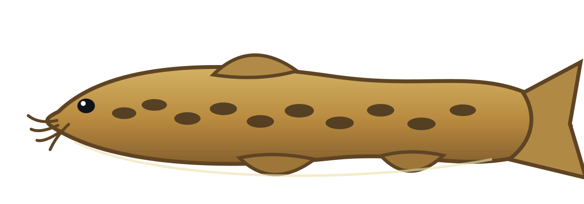
Spined loach — a small bottom-dweller
Compiled Ruhijärv fish information mentions the spined loach (Cobitis taenia). In Estonia the species belongs to protection category III. It prefers clear, slow-moving or still water with a sandy or clay bottom and often hides among vegetation or buries itself in the sediment.
The source confirms that the species has been recorded in lake descriptions, but its current occurrence in Ruhijärv should be verified with up-to-date monitoring data.
Read the species overview →Depth and lake shape
Bathymetry and morphometric parameters
The map, model and tables explain how the lake area and volume are distributed between depth layers.
Bathymetric map
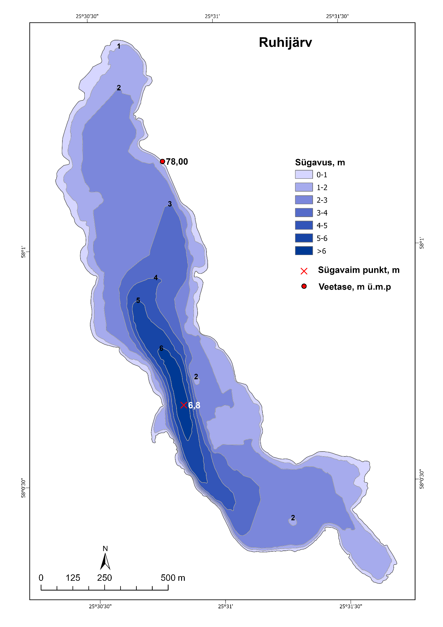
The deepest narrow trough lies along the steeper western side.
Lake-bed model
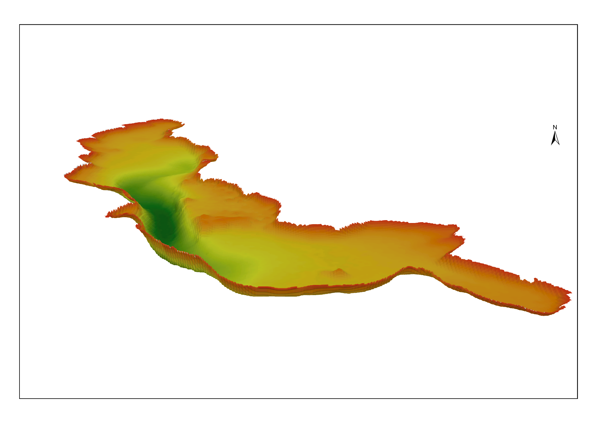
The three-dimensional view makes the western depression and the broad shallow areas easier to compare.
Tabel 3.10.1. Morphometric parameters
| Water surface elevation | 78,00 m ümp |
|---|---|
| Maximum length | 2 380 m |
| Wave fetch | 2 070 m |
| Maximum width | 600 m |
| Water surface area | 84,8 ha / 0,85 km² |
| Island area | – |
| Total area | 84,8 ha / 0,85 km² |
| Maximum depth | 6,8 m |
| Average depth | 2,5 m |
| Relative depth | 0,7% |
| Volume | 2 106 600 m³ |
| Shoreline length | 6,6 km |
| Shoreline development | 2,0 |
| Mean slope | 1,7° |
Tabel 3.10.2. Areas and volumes of water layers
| Layer | ha | km² | Depth interval | m³ |
|---|---|---|---|---|
| 0 m | 84,8 | 0,85 | 0–1 m | 804 592 |
| 1 m | 76,4 | 0,76 | 1–2 m | 677 775 |
| 2 m | 54,2 | 0,54 | 2–3 m | 358 045 |
| 3 m | 20,7 | 0,21 | 3–4 m | 149 322 |
| 4 m | 10,3 | 0,10 | 4–5 m | 77 626 |
| 5 m | 5,6 | 0,06 | 5–6 m | 34 283 |
| 6 m | 1,6 | 0,02 | 6–7 m | 4 972 |
The table shows why Ruhijärv is considered relatively shallow: the area narrows rapidly below three metres.
Learning material
A lake as a natural-science learning environment
The content below gives teachers facts and explanations that can be used directly or connected to their own paid CMS assignments.
Lake shape
Bathymetry is the underwater equivalent of a topographic map. Closely spaced lines show a steeper slope.
Water layers
Layer areas and volumes help explain how much habitat exists at different depths.
Heating and mixing
Shallow water warms quickly, while wind can mix a large part of the water column and resuspend sediment.
Shore and vegetation
Gentle shallow shores offer more room for aquatic plants than steep deep shores.
Volume and resilience
Lake volume influences water exchange, temperature changes and the effect of pollution.
Repeated surveys
Repeated measurements reveal changes in water level, shoreline, sedimentation and lake volume over time.
Support Geofishing development
Connect scientific data with a location-aware application
Support helps Geofishing connect the data with a location-aware map application and app, develop a STEM AI agent that assists with lake-related information based on location, determine and verify the water-level reference point, test location-based depths and add field-verified practical information. Tallinn University’s scientific lake information and bathymetric map remain freely available to everyone.
STEM AI agent connected to maps
Water-level reference point
Location-based depth verification
Access, restrictions and hazards
Research and bathymetric mapping
Tallinna Ülikool
Loodus- ja terviseteaduste instituut
Ökoloogia keskus
Authors: Tiit Vaasma, PhD; Egert Vandel, PhD
Funder: Keskkonnainvesteeringute Keskus
„Eesti väikejärvede batümeetriline seire 2024”, Tallinn 2025
Web presentation and practical information layer
Geofishing Technology
Geofishing Technology STEM AI connected to maps based on location.
Field verification of the reference level and depths and connection with the Geofishing BETA platform.
Practical sources, access, restriction and safety data.
Future photographs: Geofishing’s own field photographs.